The systems will be managed by DOE’s Pacific Northwest National Laboratory (PNNL) based in Richland, southeastern Washington State.
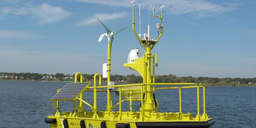
The WindSentinel is a wind resource assessment buoy that uses LiDAR to accurately measure wind speed, wind direction, and turbulence offshore up to blade-tip heights of 200 meters. The system claims the most LiDAR offshore wind resource assessment ever conducted, 36 miles (57.9km)